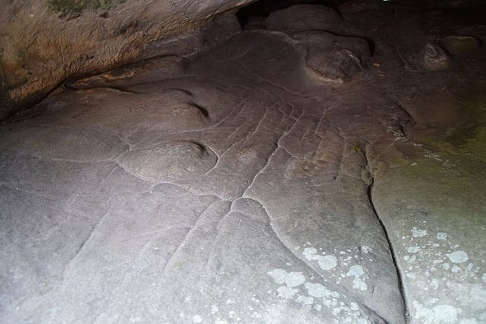
A groundbreaking discovery in France has revealed what may be the world’s oldest three-dimensional map, created by Paleolithic people around 13,000 years ago.
This incredible find, carved into a sandstone rock shelter, shows just how advanced early humans were in understanding and depicting their environment.
The research, published in the Oxford Journal of Archaeology, highlights the ingenuity and creativity of our distant ancestors.
The discovery was made at the Ségognole 3 rock shelter in the Paris Basin.
This site has been known since the 1980s for its artistic engravings, including images of two horses and a figure representing a female form.
However, new research shows that the shelter’s floor contains a miniature model of the surrounding landscape, including features like water flows, valleys, and lakes.
Dr. Médard Thiry from the Mines Paris—PSL Center of Geosciences led the study, with contributions from Dr. Anthony Milnes of the University of Adelaide.
Their findings suggest that Paleolithic people shaped the sandstone floor to mimic the natural flow of water and other geological features in the region.
“What we’ve described isn’t a map as we think of it today,” explained Dr. Milnes. “It doesn’t show distances, directions, or travel times.
Instead, it’s a three-dimensional representation of how the landscape worked—where water flowed, where streams converged, and how lakes or swamps formed.”
For the Paleolithic people, understanding water flow and recognizing key features of the land would have been essential for survival.
These early humans likely depended on this knowledge for finding drinking water, hunting, and navigating their environment.
Dr. Thiry explained that the sandstone was sculpted to promote the flow of rainwater, creating paths that would direct it to specific areas.
This wasn’t a random process—close examination of the rock revealed fine details that couldn’t have occurred naturally. The modifications show a remarkable level of engineering skill and imagination.
“Our research demonstrates that early humans were capable of modifying the land around them in highly sophisticated ways,” said Dr. Milnes. “This discovery highlights their advanced mental capacity and creativity.”
Interestingly, the researchers believe that this miniature landscape may have held symbolic or mythical significance for the Paleolithic people. The three-dimensional map is located just two to three meters from a carving of a female form that appears to channel water, suggesting a possible connection between the two.
Dr. Thiry speculates that these features may have represented deeper beliefs about life, nature, and the role of water in sustaining both. “The meaning behind these features is likely beyond our understanding,” he said, “but they clearly held profound importance for the people who created them.”
Before this discovery, the oldest known three-dimensional map was a portable rock slab engraved during the Bronze Age, about 3,000 years ago. That map depicted a local river system and mounds, resembling more modern navigational tools. The new discovery in France, however, pushes the timeline of map-making back by 10,000 years.
The researchers emphasized the importance of collaboration across different scientific fields, such as archaeology, geology, and geomorphology, in making such discoveries. “The best insights come from combining knowledge from different disciplines,” said Dr. Milnes. “It’s also vital to revisit sites and reinterpret past findings as new techniques and ideas emerge.”
This ancient map offers a fascinating glimpse into the lives and minds of Paleolithic humans. It shows not only their deep understanding of their environment but also their ability to think creatively and engineer solutions to practical problems.
“This discovery provides valuable insight into the intelligence and resourcefulness of early humans,” Dr. Thiry said. “It’s a reminder that our ancestors were far more advanced than we often imagine.”
As researchers continue to study the site, they hope to uncover even more clues about the beliefs, practices, and daily lives of the people who created this extraordinary 3D map so many thousands of years ago.
Source: University of Adelaide.


