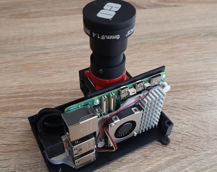
With GPS jamming attacks becoming more common in drone warfare, researchers from the University of South Australia (UniSA) have developed a cutting-edge navigation system that uses stars for guidance instead of relying on the global positioning system (GPS).
This celestial navigation system provides a reliable and cost-effective alternative for drones operating in areas where GPS is unavailable or compromised.
A simpler and smarter system
UniSA researcher Dr. Samuel Teague and his team have combined celestial navigation with vision-based technology to create a lightweight system that can easily integrate into standard drones.
Unlike traditional star-based navigation systems, which are bulky and expensive, this new approach is simpler, lighter, and more affordable.
It doesn’t require stabilization hardware, making it ideal for smaller drones.
“This type of navigation is perfect for missions over oceans or in warfare zones where GPS jamming is a threat,” says Dr. Teague.
“It can also be used for environmental monitoring in remote areas.”
The system works by using an algorithm that processes visual data from stars and feeds it into the drone’s autopilot.
Tests on a fixed-wing drone showed accurate positioning within four kilometers—a remarkable achievement for such a compact and cost-effective system.
The new celestial navigation system offers several benefits:
- Jamming Resistance: Unlike GPS, which relies on radio signals that can be jammed or intercepted, this system uses passive celestial cues, making it immune to jamming.
- Low Cost and Lightweight: Built with readily available components, the system is affordable and light enough for small drones.
- Non-Emissive Navigation: Since the system doesn’t emit signals, it’s harder to detect, offering added security in sensitive operations.
Senior researcher Professor Javaan Chahl says the technology can greatly improve the capabilities of uncrewed aerial vehicles (UAVs) in various industries.
“Whether it’s environmental monitoring in remote locations or long surveillance missions in GPS-denied environments, this system offers a dependable new capability,” he explains.
A solution for GPS-denied zones
GPS jamming and denial are growing concerns, particularly in defense and surveillance operations.
This system provides a much-needed solution, allowing drones to navigate independently of GPS signals. The technology is versatile enough for use in commercial drones as well as more advanced defense applications.
The project is part of UniSA’s research program aimed at advancing drone technologies for both civilian and defense purposes. Supported by the Commonwealth Scholarships Program and the Australian Government Research Training Program, it highlights UniSA’s dedication to innovation in autonomous systems.
By turning to the stars for navigation, researchers have developed a reliable and affordable solution that could transform how drones operate in challenging environments.


