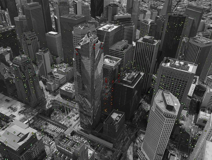
Two space satellites called Sentinel-1 are helping scientists study why some buildings and areas of land are slowly sinking.
One example is the Millennium Tower in San Francisco, a giant skyscraper finished in 2009 that is sinking by a few centimeters each year.
The reason behind the tower’s sinking isn’t certain, but it’s thought to be connected to the foundation piles, which are the deep supports of the building, not resting firmly on solid rock underneath the ground.
To study this, scientists used radar scans from the Sentinel-1 satellites to detect tiny changes on the surface of the earth, down to millimeters.
This method works especially well on buildings since they reflect the radar beam back to the satellites really well. What’s more, these twin satellites can cover large areas and come back frequently to check for any changes.
The scientists from Norut, PPO.labs, and Geological Survey of Norway, in collaboration with the European Space Agency (ESA), have also mapped movements in other parts of San Francisco and its neighboring areas.
They found that some buildings along the Hayward Fault, an earthquake-prone zone, and the newly reclaimed land in the San Rafael Bay, are also sinking. Interestingly, they detected a rise in land around the city of Pleasanton, likely because of groundwater coming back after a four-year drought that ended in 2015.
The learnings from San Francisco are also helping European cities that face similar problems. For instance, an area around Oslo’s train station in Norway is sinking because it’s built on reclaimed land. While the newer buildings have better foundations and are stable, the older parts are sinking.
John Dehls, from the Geological Survey of Norway, believes that Sentinel-1 will be a reliable tool for monitoring land movements not only in Norway but around the world. The goal is to move from studying specific cases to monitoring land deformation across entire countries or even continents.
According to Dag Anders Moldestad from the Norwegian Space Centre, Sentinel-1 is making it possible to start services that can map how the ground is moving in different nations. Because the data from the Copernicus program is open and regularly updated, these services can be both cost-effective and reliable.
In Norway, they have started a project to offer nationwide deformation products for free to the public. Several other European countries are working to set up similar services.
These Sentinel-1 satellites not only watch land movements but also feed information to various other services.
These include monitoring sea ice in the Arctic, keeping an eye on the marine environment, mapping forests, water, and soil, and even providing aid in humanitarian crises.


