In the classic example of mountain-building, the Indian and Asian continental plates crashed – and continue colliding today – to form the world’s largest and highest geologic structures:
The Himalayan Mountains and the Tibetan Plateau.
Despite the importance of these formations, which influence the global climate through atmospheric circulation and seasonal monsoons, experts have proposed contradicting theories about how tectonic plates below the surface created the iconic behemoths.
Now, using geochemical data from 225 hot springs, scientists have mapped the boundary between the Indian and Asian continental plates, shedding light on processes occurring deep below the surface.
The findings, which have implications for mineral formation, appear in the current issue of Proceedings of the National Academy of Sciences.
“A principal debate amongst geologists is whether or not continental collision looks like oceanic collision,” said senior study author Simon Klemperer, a geophysics professor at Stanford’s School of Earth, Energy & Environmental Sciences (Stanford Earth).
“Because there are too few measurements, seismology wasn’t giving us the answer – that’s why I took up geochemistry as a totally different way to measure things.”
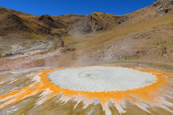
Klemperer has spent the better part of a decade traveling to Tibet and India to collect samples to support his theory that chemicals bubbling to the surface could be used to understand what’s happening 50 miles below.
He and his colleagues tracked down remote geothermal springs for hundreds of miles across the mountains and plateau – about the distance from Canada to Mexico in the western U.S.
Using the noble gas helium, which doesn’t react with other chemicals, the study authors determined which springs originated from each continental plate.
One helium isotope signature revealed when the gas came from the hot mantle – the Asian plate – while a different signature indicated the much colder Indian plate.
The research shows that the colder plate is only detected in the south, beneath the Himalayas, while further north, India is no longer touching Tibet above it – it’s separated from Tibet by a wedge of hot mantle.
The results indicate that an old theory that the Indian plate lies flat beneath Tibet is no longer tenable.
“It’s amazing that we now have this remarkably well-defined boundary just a few kilometers wide at the surface above a plate boundary that is 100 kilometers deep,” Klemperer said.
Subduction vs. collision
In oceanic subduction, material in the subsurface is recycled into the Earth’s mantle when the cooler, heavier plate dives under a continental plate and sinks.
The process occurs in zones like the Ring of Fire, which is known for frequent earthquakes and active volcanoes.
In continental collision, researchers have hypothesized that subduction of ocean crust dragged the two continents closer together until they collided, closing up the subduction zone for mountain building to occur.
This evidence of the continental boundary below Tibet introduces the possibility that the continental crust is releasing fluids and melting – just as it would happen in oceanic subduction.
“This says that we shouldn’t be looking at continental collision and oceanic subduction as two different things – we should be looking at them as the same thing with somewhat different flavors because geometrically, they look the same,” Klemperer said.
Tectonic sea change
In the 1960s, the theory of plate tectonics revolutionized the Earth sciences by explaining how geologic plates drift apart and into each other, causing mountain building, volcanic eruptions and earthquakes.
But researchers understand little about why plates move the way they do.
Klemperer said the new findings add an important element of understanding, with potential ramifications about what controls the convection that drives plate tectonics.
Even though it’s a continental collision, the Indian plate diving into the mantle helps control the pattern of convection – it changes the way we understand how elements and rock types are distributed and re-distributed on the Earth, he said.
The study builds on previous research in which Klemperer and his colleagues imaged the Himalaya collision zone using seismic data and found that as the Indian tectonic plate moves from the south, the thickest and strongest part of the plate dips beneath the Tibetan plateau and causes tears in the Indian plate. Those tears were in the same location as helium fluxes in the hot springs.
“We’re seeing the same processes through these different lenses, and we have to figure out how to put them together,” Klemperer added.
Mineral implications
Ever since the Spaniards conquered South America in search of gold, civilizations have known about rich mineral deposits in places like the Andes Mountains, which are part of the Ring of Fire.
Southern Tibet has more recently also been recognized as a rich mineral province, with gold, copper, lead, zinc and other deposits, which are difficult to explain using only the old models of continental collision.
“The largest copper deposits occur in granites that are produced by melting of the hot mantle wedge – that shouldn’t happen in continental collision if it looks like the old model, but we know it did happen because we have all these minerals in Tibet,” Klemperer said.
“Our work tells us about the large-scale tectonics of continental collision and suggests that we might expect to see the same sort of mineral deposits in continental-collision environments as oceanic-subduction environments.”
As the only active continental collision on our planet, the Himalayas and Tibet also offer a glimpse into how other mountain ranges have formed in the past and may form in the future.
“Australia is just beginning to collide with the Indonesian block – that’s continental collision beginning to happen,” Klemperer said. “Tibet is the type-example to be solved and we hope it’s an analog for everywhere else about how this happens on Earth.”
Written by Danielle Torrent Tucker.


