In September 2023, scientists detected a strange seismic signal that lasted for nine days.
This mysterious signal puzzled researchers worldwide until an international team, including seismologists Alice Gabriel and Carl Ebeling from UC San Diego’s Scripps Institution of Oceanography, uncovered the cause: a huge landslide in East Greenland triggered a mega-tsunami.
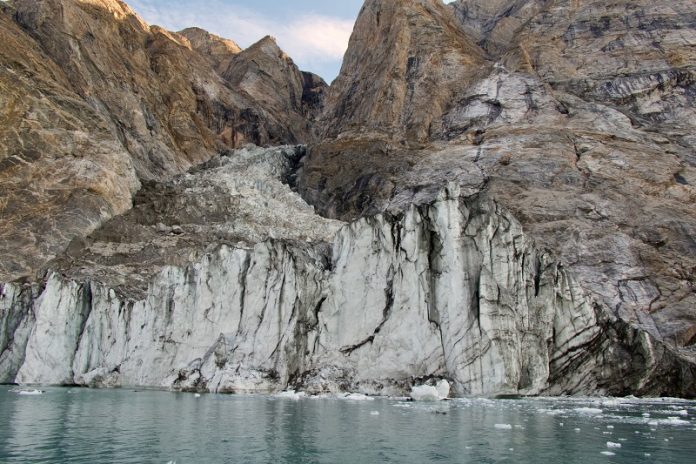
The landslide occurred when a mountaintop collapsed into the sea, creating a 200-meter (650-foot) tall tsunami in a narrow fjord.
The giant wave rocked back and forth for nine days, generating seismic waves that were detected by monitoring stations around the globe.
This back-and-forth wave movement is known as a “seiche.”
Fortunately, no people were harmed, but the waves caused about $200,000 in damage to a research station on nearby Ella Island.
The impact of climate change
The collapse of the mountain was fueled by climate change. Melting glaciers at the base of the mountain destabilized 25 million cubic meters (33 million cubic yards) of rock and ice, which then crashed into the sea.
This massive landslide triggered the tsunami and the unusual seismic activity. Scientists warn that as climate change continues to melt glaciers in Earth’s polar regions, more destructive landslides like this one could happen.
“When the seismic signal first appeared, no one knew what caused it,” said Kristian Svennevig, a geologist at the Geological Survey of Denmark and Greenland (GEUS) and the lead author of the study.
“It took a huge effort from many scientists working together to solve the mystery.”
A seismic puzzle
The seismic signal detected in September 2023 was unlike anything scientists had seen before. Earthquakes typically create rapid, busy-looking signals, but this one oscillated at a slow 92-second interval.
It also remained strong for days, which is unusual for typical seismic events.
As scientists began to investigate, they learned that a massive landslide had occurred in a remote Greenland fjord on September 16.
By combining satellite images, field measurements, and computer simulations, the team was able to confirm that the landslide was the cause of the unusual seismic signal.
The research involved 68 scientists from 41 institutions around the world. They carefully analyzed the amount of rock and ice involved in the landslide and used supercomputers to simulate the dynamics of the landslide and the resulting tsunami.
The simulations helped the researchers understand how the giant wave formed and why it lasted so long.
The study revealed the complex risks posed by climate change, especially in polar regions. While no one was harmed by the Greenland landslide and tsunami, the fjord is located near a route commonly used by cruise ships, showing the need for better monitoring of these areas as climate change accelerates.
This event is a reminder that there is still much to learn about the Earth’s processes. By studying similar seismic signals, researchers may be able to uncover more seiches and better understand the conditions that create them.
“This was an exciting scientific challenge,” said Robert Anthony, a co-author of the study. “It took contributions from many scientists across the world to solve the puzzle.”
This research highlights the importance of understanding and monitoring the effects of climate change, especially in vulnerable regions like Greenland.
As the climate continues to warm, events like this landslide may become more frequent, making it crucial for scientists to stay alert and prepared for future challenges.


