For the first time in history, scientists have taught a computer program in space to identify changes in cloud cover.
This cutting-edge project was led by a group of researchers from the University of Oxford, led by Vít Růžička, a computer science student.
So, why does this matter?
It’s because most satellites can only collect information but can’t make decisions on their own.
They have to send the data back to Earth to be processed, which could take hours or even days. This isn’t ideal if you want quick responses to sudden changes like natural disasters.
That’s why the team wanted to train a machine learning program in space – to get information and take actions much faster.
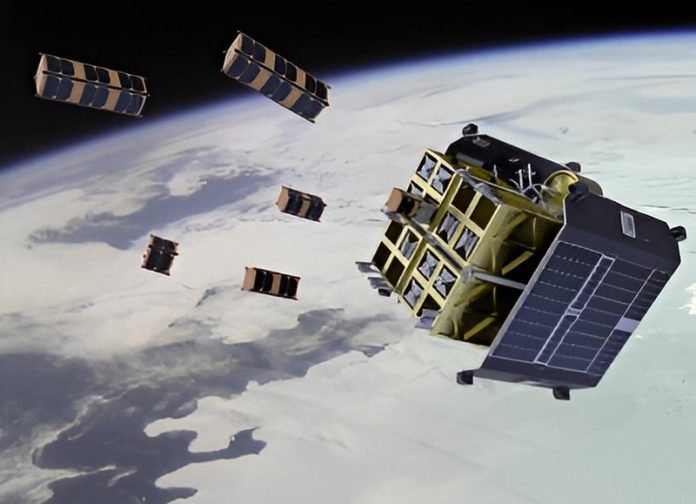
In 2022, the researchers got the chance to work on the Dashing through the Stars mission. This mission invited ideas for projects to be done on the ION SCV004 satellite, which was launched earlier that year.
The researchers were given the green light to send the program to the satellite already circling the Earth.
Here’s the cool part – they trained their program directly on the satellite to identify changes in cloud cover from images taken from above. The program was trained to learn from just a few samples, making it efficient and fast. In tech language, it’s called “few-shot learning”.
Růžička and his team created a model called RaVAEn. This model reduces large image files to vectors of 128 numbers, or in simpler terms, it makes big files much smaller.
During the learning stage, the model learns which parts of this smaller file are most important for spotting the changes it’s trying to identify. In this case, it was trained to spot whether there’s a cloud present or not.
The most impressive thing is that training this model only took about one and a half seconds, and it can now identify clouds in a new image in just about a tenth of a second! And the area it covers? Imagine around 450 soccer fields. That’s a lot!
But it doesn’t stop there. The team is planning to make the model even better. They want it to spot different types of changes like floods, fires, and deforestation, and also recognize natural changes like the changing colors of leaves in different seasons.
They are also aiming to make the model work with more complex images. This could lead to the detection of things like methane leaks, which is super important for fighting against climate change.
In space, the environment is really harsh, and this affects the sensors on satellites that often need regular fixing. But with machine learning in space, this issue could be solved.
If one satellite has accurate information, it can train the other satellites in its group. This could be used to fix sensors that have stopped working well over time or have been affected by sudden changes in the environment.
This groundbreaking achievement could revolutionize how we monitor and respond to changes on Earth, making for a more proactive and efficient approach to managing disasters and combating climate change.
Follow us on Twitter for more articles about this topic.
Source: University of Oxford.


