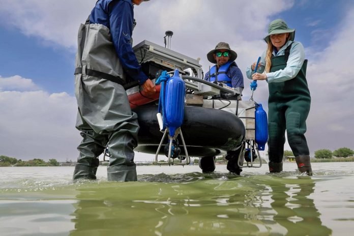
Researchers at The University of Texas at El Paso have constructed a fully autonomous boat capable of carrying out bathymetric surveys, which involve mapping the depth and terrain of bodies of water like oceans, rivers, and lakes.
The team hopes that this robotic boat can simplify the survey process, traditionally requiring a crew of individuals, and also assist with reconnaissance missions.
Led by Dr. Laura Alvarez, an assistant professor in UTEP’s Department of Earth, Environmental and Resource Sciences, the research team developed a self-driving boat equipped with advanced technology.
Over several years, Fernando Sotelo, a master’s student in science and electrical engineering, refined the boat’s design to make it fully autonomous and responsive to environmental conditions.
The autonomous boat measures 3 feet by 3 feet and features a circular aluminum structure resting on a durable inner tube.
It operates with four thrusters, allowing it to travel up to 5 feet per second and rotate 360 degrees. With a solar panel and lithium battery, the boat can last up to four hours at sea and cover an area of up to 472,400 square feet.
To map the underwater terrain, the boat is equipped with a multibeam echosounder, which uses sonar technology.
By emitting sound waves from the boat’s bottom and measuring the time it takes for the waves to hit the seafloor and return, the depth of the water can be calculated. The returned sound waves also provide information about the type of material on the seafloor.
In a successful demonstration, the research team created 2D and 3D maps of sections of Ascarate Lake in El Paso, Texas, and Grindstone Lake in Ruidoso, New Mexico.
These maps offer detailed information about the depth and shape of the underwater landscapes, aiding scientists in water-related studies and research.
Dr. Alvarez plans to use the autonomous boat for her own research, focusing on studying the flow and depth of the Rio Grande River.
The research team has made the boat’s replication instructions available in their published paper, aiming to encourage others to engage in similar projects and further innovation.
The development of a fully autonomous boat for bathymetric surveys marks a significant milestone in underwater exploration.
This technology simplifies the survey process and opens up new possibilities for scientific research and reconnaissance missions.
By accurately and efficiently mapping underwater terrains, the autonomous boat contributes to our understanding of water bodies, their evolution, flow patterns, and potential applications in various fields.
Source: KSR.


